250118 Cattle Point
Highrocker - Wingfoiling |
Saturday January 18, 2025 11:32 AM |
| Spot | Cattle Pt |
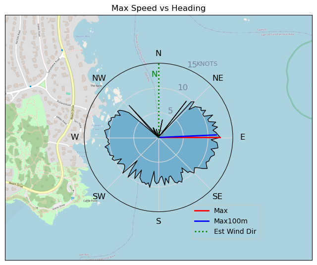
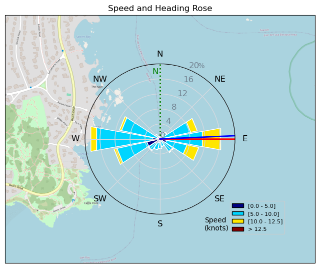
| Conditions | NNE 8-14, Mostly flat |
| TOW | 1.0 hours |
| Toys | 146L Starboard Inflatable Air Foil Deluxe SC Wing Board |
| 6.2m Cabrinha Mantis | |
| 2050sqcm Axis 1020mm Carbon Front Wing | |
| 900mm Axis Aluminum Mast | |
| Details | It was like finding a $20 in my wing bag pocket. Pleasant surprise! Light winds, but workable and was foiling before the marker. Cold at the start, but warmed up nicely with the sunshine. It was so cool to repeatedly be crossing runs with Bobson and RDog brought summery vibes. Nice winds between the marker and the yellow buoy. TnT came out near the end when the winds were reducing. Looking forward to more on Sunday! [from Session Log on Saturday January 18, 2025] |
Speed (3s average)
| Speed | knots | km/h |
|---|---|---|
| Avg overall | 7.7 | 14.3 |
| Avg in motion | 8.1 | 15.0 |
| Max | 12.5 | 23.1 |
| Max 100m | 12.0 | 22.2 |
| Max 250m | 11.4 | 21.0 |
| Max 500m | 10.6 | 19.6 |
| Max 2s | 12.5 | 23.1 |
| Max 10s | 12.1 | 22.4 |
| Max Alpha (500/50m) | 9.9 | 18.3 |
| Avg Foiling | 8.8 | 16.2 |
Times and Duration
| Start | Sat Jan 18, 11:32 AM |
| End | Sat Jan 18, 12:48 PM |
| Duration | 01:15:52 |
| In motion | 01:12:08 |
| Paused (< 3 km/h) | 00:03:25 |
| Foiling | 01:03:15 |
| Not Foiling (< 8 km/h) | 00:12:18 |
| Longest Foiling Segment | 00:11:32 (3.2 km) |
| Last Calculated | Sat Jan 18, 4:30 PM |
Track Information
| Distance | 18.1 km |
| # Trackpoints | 1458 |
| Avg Trackpoint distance | 12.4 m |
| Number of Turns | 54 |
| Foiling Turns (> 8 km/h) | 48 |
| Foiling Turn Percentage | 89% |


Category: Wingfoiling
3 days ago

Created 3 days ago
Highrocker |
Please register/login to download this track.
This track was downloaded 0 time(s). |
| 31 CP - Jan 19 2025 |
| 53 Cruising altitude |
| 49 DesperadoRedux |
| 49 250119 Cattle Point |
| 55 CP - Sunday Funday On the Water |
Please wait while loading suggestions..
Please wait while loading suggestions..
You must login to post comments.