Singing Sands 01/16
mayday - Wingfoiling |
Thursday January 16, 2025 12:44 PM |
| Spot | [Secret spot] |
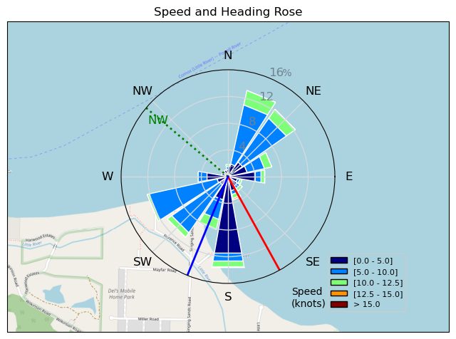
| Conditions | NW 15-25, 2m swell |
| TOW | 1.0 hours |
| Toys | 115 quattro drifter |
| 5m duotone slick sls | |
| 1220 reedin flight attendant | |
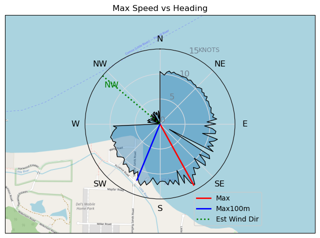
| Details | Strong NW, which for Comox means only Singing Sands area available- which is good/bad for me. Good is a relatively easy angled shore launch; bad it is full strength all down the straight- so the swell really builds quickly. I'm always a bit intimidated there, so stayed close to shore. After a half hour start to feel more comfortable, and thinking I'm Joe Cool again- until winger Tony comes along and makes me look like a rank beginner ( not hard to do). Wind continued to build so i pulled the pin and went to play out front of Pt.Holmes in the flat water. [from Session Log on Thursday January 16, 2025] |
Speed (3s average)
| Speed | knots | km/h |
|---|---|---|
| Avg overall | 5.9 | 10.9 |
| Avg in motion | 8.0 | 14.8 |
| Max | 14.0 | 25.8 |
| Max 100m | 11.8 | 21.9 |
| Max 250m | 10.6 | 19.7 |
| Max 500m | 10.3 | 19.0 |
| Max 2s | 13.9 | 25.8 |
| Max 10s | 12.8 | 23.7 |
| Max Alpha (500/50m) | 10.1 | 18.6 |
| Avg Foiling | 9.1 | 16.9 |
Times and Duration
| Start | Thu Jan 16, 12:44 PM |
| End | Thu Jan 16, 1:48 PM |
| Duration | 01:04:04 |
| In motion | 00:47:11 |
| Paused (< 3 km/h) | 00:10:47 |
| Foiling | 00:37:40 |
| Not Foiling (< 8 km/h) | 00:20:18 |
| Longest Foiling Segment | 00:06:24 (1.8 km) |
| Last Calculated | Thu Jan 16, 3:26 PM |
Track Information
| Distance | 11.7 km |
| # Trackpoints | 3833 |
| Avg Trackpoint distance | 3.0 m |
| Number of Turns | 35 |
| Foiling Turns (> 8 km/h) | 25 |
| Foiling Turn Percentage | 71% |


Category: Wingfoiling
5 days ago

Created 5 days ago
mayday |
Please register/login to download this track.
This track was downloaded 0 time(s). |
| 31 CP - Jan 19 2025 |
| 54 Cruising altitude |
| 49 DesperadoRedux |
| 49 250119 Cattle Point |
| 55 CP - Sunday Funday On the Water |
Please wait while loading suggestions..
Please wait while loading suggestions..
You must login to post comments.