Willows Mixed Bag
ThePope - Wingfoiling |
Sunday November 24, 2024 9:29 AM |
| Spot | Willows Bch |
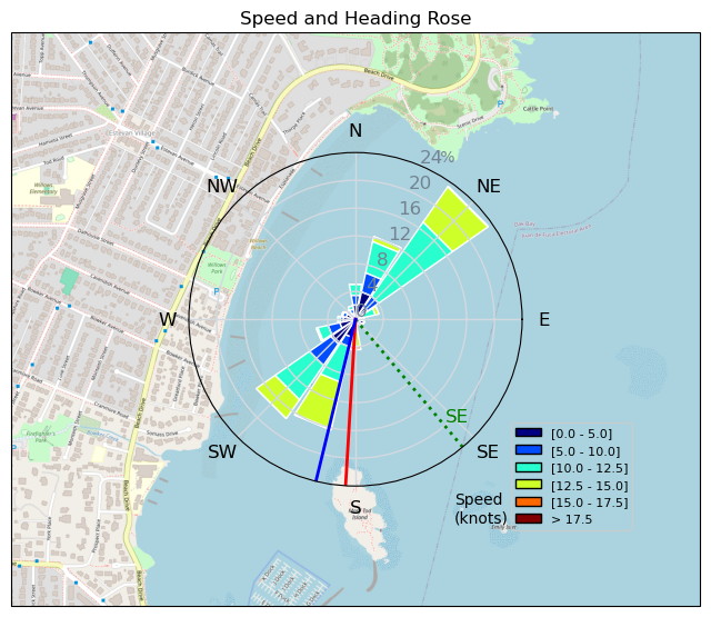
| Conditions | SE 22-28, 1m |
| TOW | 2.0 hours |
| Toys | 99L Armstrong FG Wing SUP |
| 4m Duotone Unit | |
| 70 Armstrong Fuse | |
| 865 Armstrong Mast | |
| 220 Armstrong Glide | |
| 880 Armstrong HA | |
| Details | Launched with Bobson and TnT around 930am. I struggled to get offshore on the 75L midlength, and not wanting to damage my foil on one of the concrete outfalls I switched to the 100L and headed back out. Typical SE Willows November mixed bag conditions -- gusty winds and confused chop -- but still a pretty fun session and it was nice to be able to stay on the 4m for the whole thing. After 2 hours I started getting tired and making a lot of mistakes so I called it a day. Lots of wings out as I was packing up! [from Session Log on Sunday November 24, 2024] |
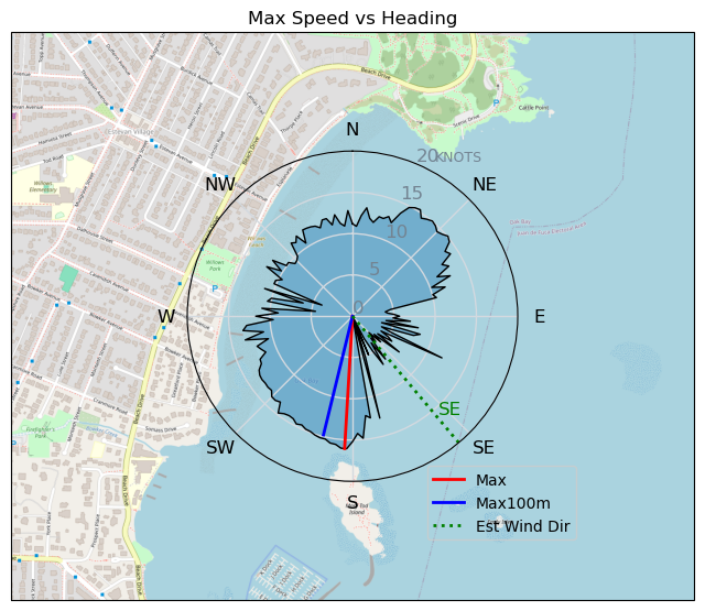
Speed (3s average)
| Speed | knots | km/h |
|---|---|---|
| Avg overall | 5.7 | 10.5 |
| Avg in motion | 8.6 | 16.0 |
| Max | 16.1 | 29.7 |
| Max 100m | 15.3 | 28.3 |
| Max 250m | 14.9 | 27.5 |
| Max 500m | 14.2 | 26.3 |
| Max 2s | 16.1 | 29.7 |
| Max 10s | 15.3 | 28.4 |
| Max Alpha (500/50m) | 10.9 | 20.2 |
| Avg Foiling | 10.8 | 19.9 |
Times and Duration
| Start | Sun Nov 24, 9:29 AM |
| End | Sun Nov 24, 11:45 AM |
| Duration | 02:16:23 |
| In motion | 01:29:52 |
| Paused (< 3 km/h) | 00:45:24 |
| Foiling | 01:02:05 |
| Not Foiling (< 8 km/h) | 01:13:11 |
| Longest Foiling Segment | 00:03:16 (1.2 km) |
| Last Calculated | Sun Nov 24, 2:06 PM |
Track Information
| Distance | 23.9 km |
| # Trackpoints | 4784 |
| Avg Trackpoint distance | 5.0 m |
| Number of Turns | 32 |
| Foiling Turns (> 8 km/h) | 4 |
| Foiling Turn Percentage | 12% |


Category: Wingfoiling
4 hours ago

Created 4 hours ago
ThePope |
Please register/login to download this track.
This track was downloaded 0 time(s). |
| 7 241124 Willows |
| 11 WillowsQuickie |
| 15 Willows - Sunday Funday Woops |
| 18 Willows Mixed Bag |
| 14 Surprise Sunday ENE. |
Please wait while loading suggestions..
Please wait while loading suggestions..
You must login to post comments.