20240912
ThePope - Wingfoiling |
Thursday September 12, 2024 6:31 PM |
| Spot | Ross Bay |
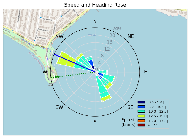
| Conditions | SW 14-16, 0.5m |
| TOW | 1.0 hours |
| Toys | 99L Armstrong FG Wing SUP |
| 7m Duotone Ventis | |
| 1475 Armstrong MA | |
| 70 Armstrong Fuse | |
| 865 Armstrong Mast | |
| 235 Armstrong Flow | |
| Popemobile | |
| Details | Surprise sunset cruise with Rupert -- great session! When I arrived at RB the wind was so light I thought I'd get skunked, but within 10 min it built, so I rigged all my biggest gear. Had an hour of super steady light winds and probably the flattest conditions I've been out in at RB. No kelp take downs! On the bike ride home I ran into Sam and stopped to chat about all the exciting things he's up to. Didn't know he was a neighbour! Awesome night. [from Session Log on Thursday September 12, 2024] |
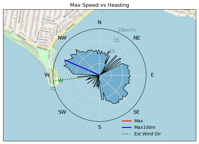
Speed (3s average)
| Speed | knots | km/h |
|---|---|---|
| Avg overall | 7.7 | 14.2 |
| Avg in motion | 9.6 | 17.7 |
| Max | 16.2 | 29.9 |
| Max 100m | 14.8 | 27.4 |
| Max 250m | 14.0 | 26.0 |
| Max 500m | 12.6 | 23.3 |
| Max 2s | 16.1 | 29.7 |
| Max 10s | 15.0 | 27.7 |
| Max Alpha (500/50m) | 11.2 | 20.7 |
| Avg Foiling | 10.7 | 19.7 |
Times and Duration
| Start | Thu Sep 12, 6:31 PM |
| End | Thu Sep 12, 7:22 PM |
| Duration | 00:50:43 |
| In motion | 00:40:39 |
| Paused (< 3 km/h) | 00:09:40 |
| Foiling | 00:33:32 |
| Not Foiling (< 8 km/h) | 00:16:47 |
| Longest Foiling Segment | 00:03:00 (1.0 km) |
| Last Calculated | Thu Sep 12, 9:24 PM |
Track Information
| Distance | 12.0 km |
| # Trackpoints | 2216 |
| Avg Trackpoint distance | 5.4 m |
| Number of Turns | 10 |
| Foiling Turns (> 8 km/h) | 4 |
| Foiling Turn Percentage | 40% |


Category: Wingfoiling
5 months ago

Created 5 months ago
ThePope |
Please register/login to download this track.
This track was downloaded 0 time(s). |
| 60 Falck’n Foot Switches |
| 60 250112 Cattle Point |
| 60 Speedy (for me) wave riding |
| 54 CP - TunaCan Flyby |
| 85 Rippin the right radii |
Please wait while loading suggestions..
Please wait while loading suggestions..
You must login to post comments.