Outie vs Innie
tweezer - Wingfoiling |
Saturday April 27, 2024 8:20 AM |
| Spot | Ross Bay |
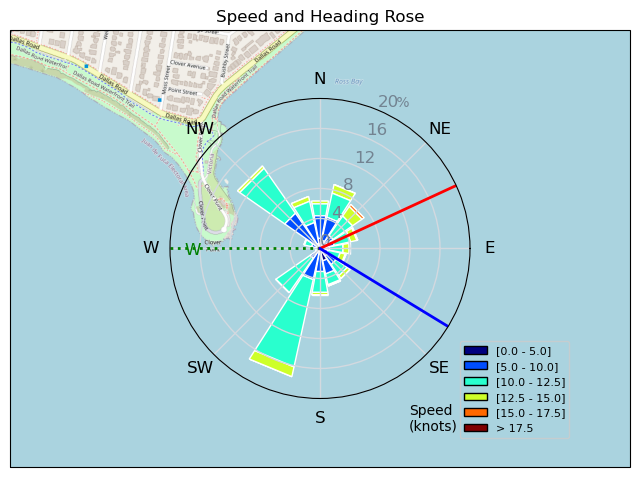
| Conditions | W 12-20, 1-2ft |
| TOW | 1.5 hours |
| Toys | 62.5cm Axis ultrashort fuse |
| 86cm Axis carbon mast v2 | |
| 1144cm2 Axis ART 1099 | |
| 360/45 Axis 360/45 skinny | |
| 5 Cabrinha Mantis | |
| 4ft9 65l Appletree Custom | |
| Details | Barely woke up in time to see ULR's "heading to RB" text. Slurped a coffee, scarfed a bagel, slipped into my suit and I also was "heading to RB". Clover Point Slop was biggest early and then it smoothed out into a serene other worldly liquid playground with butterflies. Was I still dreaming? Was it all a dream? Is my outie aware of my innie? [from Session Log on Saturday April 27, 2024] |
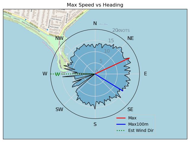
Speed (3s average)
| Speed | knots | km/h |
|---|---|---|
| Avg overall | 7.5 | 13.8 |
| Avg in motion | 9.6 | 17.8 |
| Max | 17.0 | 31.4 |
| Max 100m | 14.0 | 25.9 |
| Max 250m | 13.2 | 24.4 |
| Max 500m | 12.6 | 23.3 |
| Max 2s | 16.9 | 31.2 |
| Max 10s | 14.6 | 27.0 |
| Max Alpha (500/50m) | 11.7 | 21.7 |
| Avg Foiling | 10.4 | 19.2 |
Times and Duration
| Start | Sat Apr 27, 8:20 AM |
| End | Sat Apr 27, 10:22 AM |
| Duration | 02:01:42 |
| In motion | 01:34:26 |
| Paused (< 3 km/h) | 00:27:00 |
| Foiling | 01:23:50 |
| Not Foiling (< 8 km/h) | 00:37:36 |
| Longest Foiling Segment | 00:16:58 (5.6 km) |
| Last Calculated | Sat Apr 27, 11:55 AM |
Track Information
| Distance | 28.0 km |
| # Trackpoints | 5384 |
| Avg Trackpoint distance | 5.2 m |
| Number of Turns | 91 |
| Foiling Turns (> 8 km/h) | 67 |
| Foiling Turn Percentage | 74% |


Category: Wingfoiling
9 months ago

Created 9 months ago
tweezer |
Please register/login to download this track.
This track was downloaded 0 time(s). |
| 32 Rippin the right radii |
| 45 10/1/2025 Ross Bay |
| 51 2025NumeroUno |
| 43 Onwards to the 12th dimension |
| 44 RB omg best day of the year |
Please wait while loading suggestions..
Please wait while loading suggestions..
You must login to post comments.