sidneystyle
AJSpencer - Wingfoiling |
Friday February 16, 2024 11:13 AM |
| Spot | [Secret spot] |
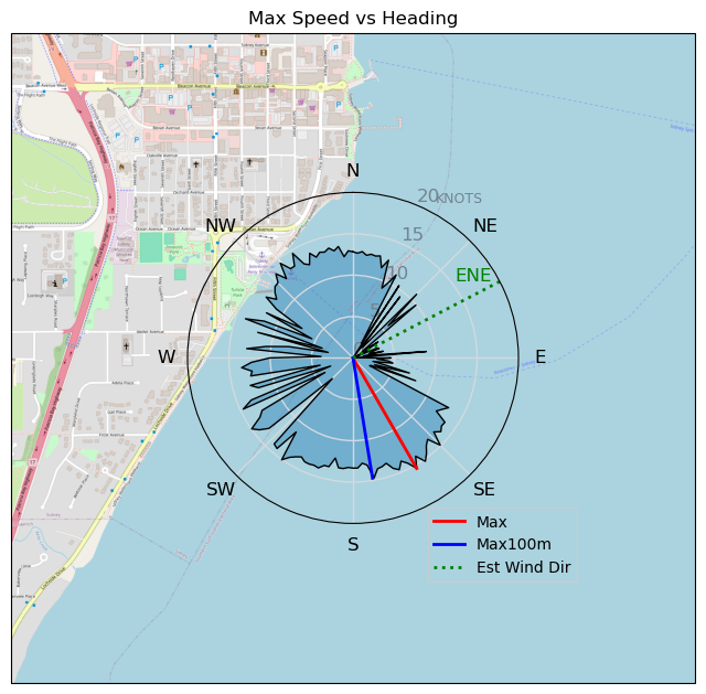
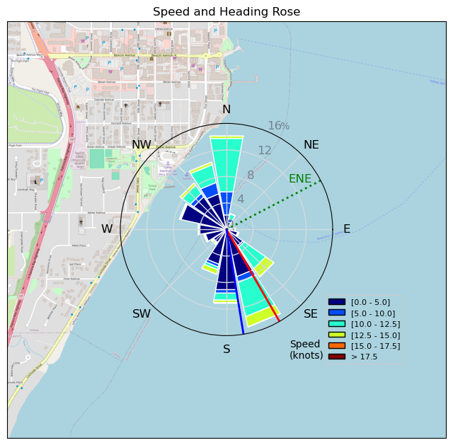
| Conditions | E 10-20, pretty flat |
| TOW | 1.5 hours |
| Toys | 400 Axis Rear Performance |
| 105 Axis Mast | |
| 1010 Axis PNG | |
| 6.5 Duotone Slick | |
| 4.0 Duotone Slick | |
| 105 Quatro Wing Drifter | |
| Details | Well, pretty typical Sidney I guess. Was planning to drive to CP but it looked nice in Sidney. I know better than to go out on a 4m in Sidney when its marginal but felt rebellious. Flew up to Sidney waterfront for some runs between the red and green cans then it started getting lighter. Long slog in from green can back to Lochside. Swapped in the big rig 6.5m and had a few runs but dropped to sub-10. Oh well. Hands were a bit cold but great to be out in the sun. [from Session Log on Friday February 16, 2024] |
Speed (3s average)
| Speed | knots | km/h |
|---|---|---|
| Avg overall | 5.2 | 9.7 |
| Avg in motion | 6.9 | 12.7 |
| Max | 15.4 | 28.5 |
| Max 100m | 14.6 | 27.0 |
| Max 250m | 13.6 | 25.2 |
| Max 500m | 13.1 | 24.3 |
| Max 2s | 15.3 | 28.4 |
| Max 10s | 14.9 | 27.5 |
| Max Alpha (500/50m) | 9.4 | 17.3 |
| Avg Foiling | 10.7 | 19.8 |
Times and Duration
| Start | Fri Feb 16, 11:13 AM |
| End | Fri Feb 16, 12:57 PM |
| Duration | 01:43:53 |
| In motion | 01:18:59 |
| Paused (< 3 km/h) | 00:24:36 |
| Foiling | 00:39:09 |
| Not Foiling (< 8 km/h) | 01:04:26 |
| Longest Foiling Segment | 00:05:55 (1.9 km) |
| Last Calculated | Fri Feb 16, 2:09 PM |
Track Information
| Distance | 16.7 km |
| # Trackpoints | 5812 |
| Avg Trackpoint distance | 2.9 m |
| Number of Turns | 38 |
| Foiling Turns (> 8 km/h) | 3 |
| Foiling Turn Percentage | 8% |


Category: Wingfoiling
11 months ago

Created 11 months ago
AJSpencer |
Please register/login to download this track.
This track was downloaded 0 time(s). |
| 33 10/1/2025 Ross Bay |
| 37 2025NumeroUno |
| 31 Onwards to the 12th dimension |
| 30 RB omg best day of the year |
| 26 250110 Ross Bay |
Please wait while loading suggestions..
Please wait while loading suggestions..
You must login to post comments.