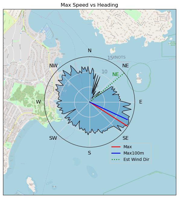
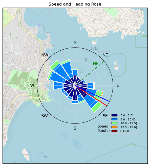
240214 Cattle Point
Highrocker - Wingfoiling |
Wednesday February 14, 2024 11:14 AM |
| Spot | Cattle Pt |
| Conditions | NE 12-16, chop to 2ft swell |
| TOW | 1.5 hours |
| Toys | 900mm Axis Aluminum Mast |
| 2050sqcm Axis 1020mm Carbon Front Wing | |
| 6m Cabrinha X3 Windows | |
| 115L JP Australia Foil Pro | |
| Details | Played Game of Foils with Idefix, WJunky, Bobson, and Steve. Lots of confusing tidal action, but the winds were fairly constant, particularly off Jemmy Jones. Bobson passed me at relativistic speeds. Danno jibed with style. WJ used distance to avoid my unpredictable course choices. Steve jumped often. I followed Idefix across to Chatham Is crossing some impressively scary whitewater on foil. That would have been a bad place to go down. Sweet two session day. Looking forward to Thursday! [from Session Log on Wednesday February 14, 2024] |
Speed (3s average)
| Speed | knots | km/h |
|---|---|---|
| Avg overall | 3.9 | 7.2 |
| Avg in motion | 7.6 | 14.0 |
| Max | 14.8 | 27.3 |
| Max 100m | 14.0 | 25.9 |
| Max 250m | 12.7 | 23.4 |
| Max 500m | 11.5 | 21.3 |
| Max 2s | 14.6 | 27.0 |
| Max 10s | 14.0 | 25.9 |
| Max Alpha (500/50m) | 11.2 | 20.8 |
| Avg Foiling | 8.4 | 15.5 |
Times and Duration
| Start | Wed Feb 14, 11:14 AM |
| End | Wed Feb 14, 2:48 PM |
| Duration | 03:34:38 |
| In motion | 01:50:43 |
| Paused (< 3 km/h) | 01:39:20 |
| Foiling | 01:20:47 |
| Not Foiling (< 8 km/h) | 02:09:16 |
| Longest Foiling Segment | 00:07:16 (1.9 km) |
| Last Calculated | Wed Feb 14, 10:42 PM |
Track Information
| Distance | 25.9 km |
| # Trackpoints | 5163 |
| Avg Trackpoint distance | 5.0 m |
| Number of Turns | 109 |
| Foiling Turns (> 8 km/h) | 34 |
| Foiling Turn Percentage | 31% |


Category: Wingfoiling
11 months ago

Created 11 months ago
Highrocker |
Please register/login to download this track.
This track was downloaded 0 time(s). |
| 33 10/1/2025 Ross Bay |
| 37 2025NumeroUno |
| 31 Onwards to the 12th dimension |
| 30 RB omg best day of the year |
| 26 250110 Ross Bay |
Please wait while loading suggestions..
Please wait while loading suggestions..
You must login to post comments.