Tropical Clover
tweezer - Wingfoiling |
Monday January 29, 2024 2:14 PM |
| Spot | [Secret spot] |
| Conditions | SW 25-30, 0-6ft |
| TOW | 3.0 hours |
| Toys | 1038cm2 Axis ART 999 |
| 86cm Axis carbon mast v2 | |
| 56cm Axis Sillyshort Advance fuse | |
| 360/45 Axis 360/45 skinny | |
| 5 Cabrinha Mantis | |
| 4ft9 65l Appletree Custom | |
| Details | Toured some beaches on the west shore in the morning. They looked fun from shore but nobody else was out at white plains beach or Iroquois point. Headed back to Maunalua which seems to be where most wingers were sailing. Noni ended her downwinder from Rice Bowl there and a few prone foilers appeared from nowhere. OP'd on the 5 all day. I'll pack the 3.5 next time! Higher tide today helped but I was a little reef-shy to venture too far from the blue to the brown. Shadows from passing clouds looked like reefs. So did my wing shadow! Kelp is less fearsome but triggers the same flinch. Kona wind might end tomorrow so I loaded up today. Waves on the outside were just like clover on a 30 knot SE. Some sphincter testers as Wingdoc would say. [from Session Log on Monday January 29, 2024] |
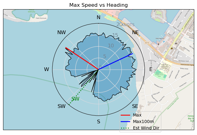
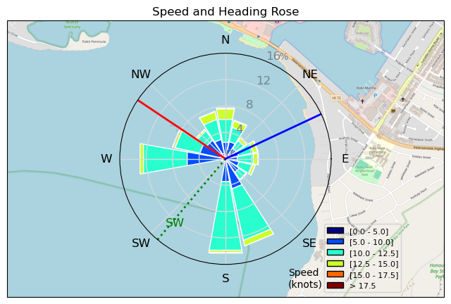
Speed (3s average)
| Speed | knots | km/h |
|---|---|---|
| Avg overall | 4.4 | 8.2 |
| Avg in motion | 9.9 | 18.3 |
| Max | 17.0 | 31.6 |
| Max 100m | 15.4 | 28.4 |
| Max 250m | 14.7 | 27.1 |
| Max 500m | 12.8 | 23.8 |
| Max 2s | 16.7 | 30.8 |
| Max 10s | 15.6 | 28.8 |
| Max Alpha (500/50m) | 11.6 | 21.4 |
| Avg Foiling | 10.5 | 19.4 |
Times and Duration
| Start | Mon Jan 29, 2:14 PM |
| End | Mon Jan 29, 7:32 PM |
| Duration | 05:18:20 |
| In motion | 02:22:48 |
| Paused (< 3 km/h) | 02:54:44 |
| Foiling | 02:10:26 |
| Not Foiling (< 8 km/h) | 03:07:06 |
| Longest Foiling Segment | 00:13:56 (4.7 km) |
| Last Calculated | Mon Jan 29, 11:27 PM |
Track Information
| Distance | 43.7 km |
| # Trackpoints | 8315 |
| Avg Trackpoint distance | 5.3 m |
| Number of Turns | 145 |
| Foiling Turns (> 8 km/h) | 116 |
| Foiling Turn Percentage | 80% |


Category: Wingfoiling
12 months ago

Created 12 months ago
tweezer |
Please register/login to download this track.
This track was downloaded 0 time(s). |
| 33 10/1/2025 Ross Bay |
| 37 2025NumeroUno |
| 31 Onwards to the 12th dimension |
| 30 RB omg best day of the year |
| 26 250110 Ross Bay |
Please wait while loading suggestions..
Please wait while loading suggestions..
You must login to post comments.