Dreamy Sunset
TunaCan - Wingfoiling |
Thursday June 29, 2023 7:52 PM |
| Spot | Ross Bay |
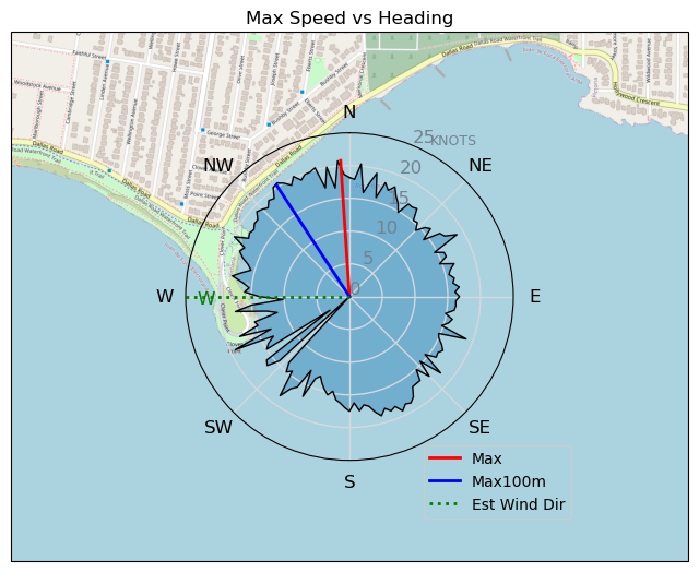
| Conditions | SW 13-18, 1 |
| TOW | 1.0 hours |
| Toys | 5 OR GLIDE |
| 5'3 Takuma TK 80 | |
| Details | Caught the sunset session with a small crew of sailers. Pretty flat, but the odd swell rolling through. Gorgeous evening and sunset - wind was pretty consistent too. Last off the water tonight! [from Sailing Log on Thursday June 29, 2023] |
Speed (3s average)
| Speed | knots | km/h |
|---|---|---|
| Avg overall | 10.3 | 19.0 |
| Avg in motion | 11.6 | 21.4 |
| Max | 20.8 | 38.5 |
| Max 100m | 19.8 | 36.6 |
| Max 250m | 17.3 | 32.0 |
| Max 500m | 16.5 | 30.6 |
| Max 2s | 20.6 | 38.1 |
| Max 10s | 19.8 | 36.6 |
| Max Alpha (500/50m) | 16.3 | 30.2 |
| Avg Foiling | 12.9 | 23.9 |
Times and Duration
| Start | Thu Jun 29, 7:52 PM |
| End | Thu Jun 29, 9:15 PM |
| Duration | 01:23:12 |
| In motion | 01:13:48 |
| Paused (< 3 km/h) | 00:08:30 |
| Foiling | 01:03:22 |
| Not Foiling (< 8 km/h) | 00:18:56 |
| Last Calculated | Thu Jun 29, 10:25 PM |
Track Information
| Distance | 26.4 km |
| # Trackpoints | 4854 |
| Avg Trackpoint distance | 5.4 m |
| Number of Turns | 93 |
| Foiling Turns (> 8 km/h) | 72 |
| Foiling Turn Percentage | 77% |


Category: Wingfoiling
2 years ago

Created 2 years ago
TunaCan |
Please register/login to download this track.
This track was downloaded 0 time(s). |
| 21 Bobson is on to something |
| 102 Wisdom of the Tweezer |
| 52 Pt.Holmes 01/07/25 |
| 84 4/1/2025 Pipers |
| 82 IV - Nailed an Hour |
Please wait while loading suggestions..
Please wait while loading suggestions..
You must login to post comments.