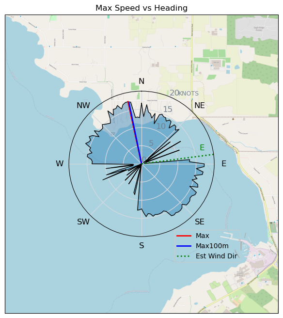
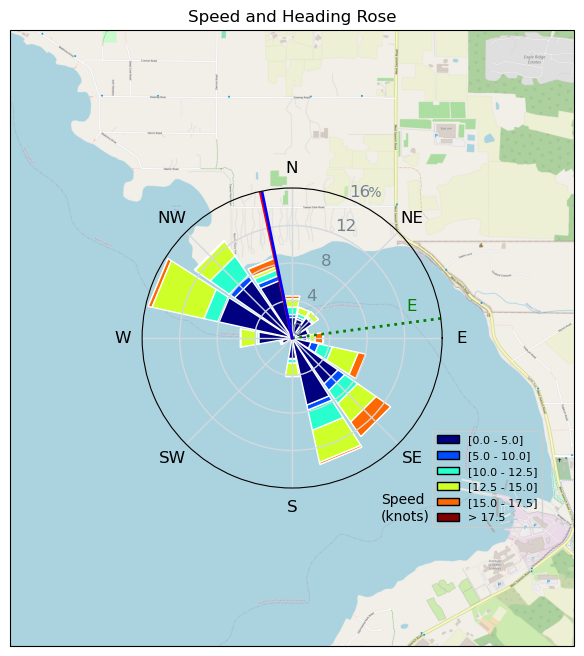
Philippine Mars rounding
AJSpencer - Wingfoiling |
Saturday December 28, 2024 12:56 PM |
| Spot | Pat Bay |
| Conditions | WSW 1-20, flat mostly |
| TOW | 1.8 hours |
| Toys | 105 Quatro Wing Drifter |
| 5.0 Duotone Slick | |
| 105 Axis Mast | |
| 999 Axis Art | |
| 300 Axis Rear Performance | |
| Details | Well I made my objective of foiling around the Philippine Mars Bomber. Wind was strange. Seemed like 20 knots around Mill Bay the entire time but dead up the inlet and only occasional short lived gusts rolling through, despite high speed wind clouds overhead. Nice to be out anyways. Some fun runs with the 999 again, but leaving me craving for a nice steady wind day. Funny to run into the apparent wind when the wind shuts off. Hope the RBFC was good. [from Session Log on Saturday December 28, 2024] |
Speed (3s average)
| Speed | knots | km/h |
|---|---|---|
| Avg overall | 3.4 | 6.3 |
| Avg in motion | 7.1 | 13.1 |
| Max | 17.5 | 32.4 |
| Max 100m | 17.2 | 31.9 |
| Max 250m | 16.8 | 31.1 |
| Max 500m | 15.6 | 28.9 |
| Max 2s | 17.5 | 32.4 |
| Max 10s | 17.3 | 32.0 |
| Max Alpha (500/50m) | 9.7 | 17.9 |
| Avg Foiling | 12.6 | 23.4 |
Times and Duration
| Start | Sat Dec 28, 12:56 PM |
| End | Sat Dec 28, 2:44 PM |
| Duration | 01:48:10 |
| In motion | 00:52:19 |
| Paused (< 3 km/h) | 00:55:45 |
| Foiling | 00:20:21 |
| Not Foiling (< 8 km/h) | 01:27:43 |
| Longest Foiling Segment | 00:03:13 (1.3 km) |
| Last Calculated | Sat Dec 28, 3:39 PM |
Track Information
| Distance | 11.4 km |
| # Trackpoints | 2621 |
| Avg Trackpoint distance | 4.3 m |
| Number of Turns | 10 |
| Foiling Turns (> 8 km/h) | 0 |
| Foiling Turn Percentage | 0% |


Category: Wingfoiling
6 days ago

Created 6 days ago
AJSpencer |
Please register/login to download this track.
This track was downloaded 0 time(s). |
| 23 CP - Light Wind Hail sesson |
| 26 cattle point - super light wind for me. |
| 21 250103 Cattle Point |
| 34 CP - Coast Guard Watching |
| 40 On the road to recovery |
Please wait while loading suggestions..
Please wait while loading suggestions..
You must login to post comments.