The day after.
sixlinewrasse - Wingfoiling |
Saturday October 19, 2024 12:46 PM |
| Spot | [Secret spot] |
| Conditions | S 20-25, Swells! |
| TOW | 1.5 hours |
| Toys | 4M Ocean Rodeo Glide A |
| 1050MA cm2 foil North Sonar | |
| 85cm C Mast North Sonar | |
| 75 cm C Fuse North Sonar | |
| S270 Stab North Sonar | |
| Details | First time on my 62 litre Quatro Drifter! (Yesterday didn't count!) Compact shape very sensitive to input, wish I was as sensitive in my output. Still able to pull off a knee start with difficulty in the wave zone, me being 77kg dry weight. Nice session despite some rain! I hardy saw any floating weeds but the ones I saw were stuck on my foil. Lots of practice knee starting after clearing the foil. Some big swell and breaking waves. [from Session Log on Saturday October 19, 2024] |
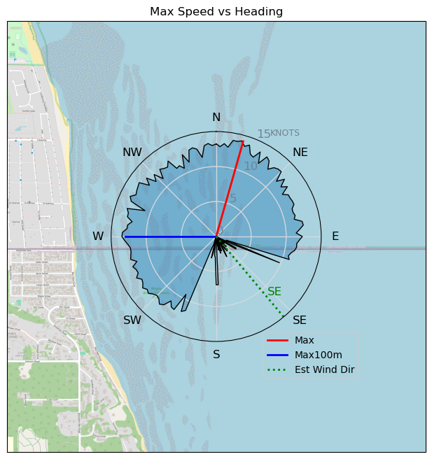
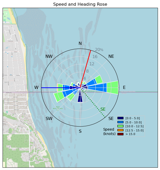
Speed (3s average)
| Speed | knots | km/h |
|---|---|---|
| Avg overall | 6.5 | 12.1 |
| Avg in motion | 8.8 | 16.4 |
| Max | 14.1 | 26.2 |
| Max 100m | 12.8 | 23.7 |
| Max 250m | 12.6 | 23.3 |
| Max 500m | 12.1 | 22.5 |
| Max 2s | 14.0 | 26.0 |
| Max 10s | 13.1 | 24.2 |
| Max Alpha (500/50m) | 11.5 | 21.2 |
| Avg Foiling | 9.8 | 18.1 |
Times and Duration
| Start | Sat Oct 19, 12:46 PM |
| End | Sat Oct 19, 2:24 PM |
| Duration | 01:37:25 |
| In motion | 01:11:56 |
| Paused (< 3 km/h) | 00:18:44 |
| Foiling | 00:59:31 |
| Not Foiling (< 8 km/h) | 00:31:09 |
| Longest Foiling Segment | 00:15:15 (4.7 km) |
| Last Calculated | Sat Oct 19, 4:44 PM |
Track Information
| Distance | 19.6 km |
| # Trackpoints | 5760 |
| Avg Trackpoint distance | 3.4 m |
| Number of Turns | 43 |
| Foiling Turns (> 8 km/h) | 34 |
| Foiling Turn Percentage | 79% |


Category: Wingfoiling
3 months ago

Created 3 months ago
sixlinewrasse |
Please register/login to download this track.
This track was downloaded 0 time(s). |
| 60 Falck’n Foot Switches |
| 60 250112 Cattle Point |
| 60 Speedy (for me) wave riding |
| 54 CP - TunaCan Flyby |
| 85 Rippin the right radii |
Please wait while loading suggestions..
Please wait while loading suggestions..
You must login to post comments.