240420 Ross Bay
Highrocker - Wingfoiling |
Saturday April 20, 2024 3:14 PM |
| Spot | Ross Bay |
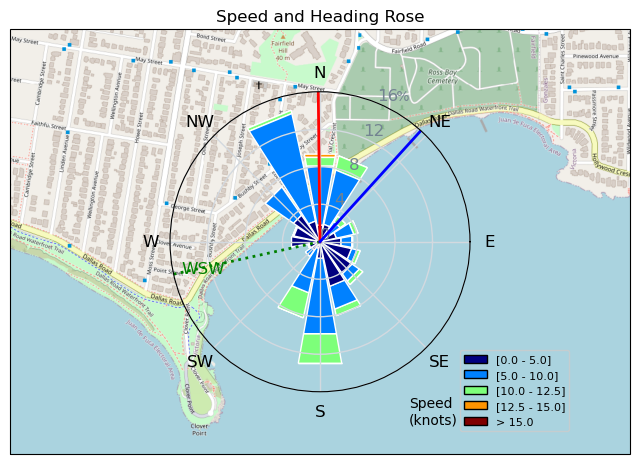
| Conditions | WNW 20-30, 3-5ft swell |
| TOW | 1.0 hours |
| Toys | 5m Cabrinha X3 Windows |
| 115L JP Australia Foil Pro | |
| Details | I was going home after checking RB and finding nothing. But, stopped at a red light I noticed the tree branches dancing. Back at RB, stuff was starting to build. I followed Idefix into the fray, but quickly turned back as I approached the point. Just too much for my limited skills. I stayed in the bay. Probably should have switched to ny 4m, but too lazy. Regardless, got some short flag outs and lots of fun carves in the ridiculous high powered winds. Not sure why, but my GPS only tracked for 20min. [from Session Log on Saturday April 20, 2024] |
Speed (3s average)
| Speed | knots | km/h |
|---|---|---|
| Avg overall | 5.3 | 9.9 |
| Avg in motion | 8.7 | 16.0 |
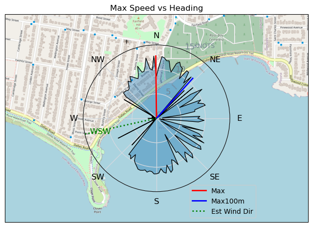
| Max | 12.7 | 23.6 |
| Max 100m | 12.0 | 22.2 |
| Max 250m | 11.2 | 20.8 |
| Max 500m | 10.3 | 19.1 |
| Max 2s | 12.7 | 23.5 |
| Max 10s | 12.1 | 22.4 |
| Max Alpha (500/50m) | 9.6 | 17.8 |
| Avg Foiling | 8.6 | 16.0 |
Times and Duration
| Start | Sat Apr 20, 3:14 PM |
| End | Sat Apr 20, 3:38 PM |
| Duration | 00:24:09 |
| In motion | 00:14:55 |
| Paused (< 3 km/h) | 00:08:36 |
| Foiling | 00:14:07 |
| Not Foiling (< 8 km/h) | 00:09:24 |
| Longest Foiling Segment | 00:09:08 (2.4 km) |
| Last Calculated | Sat Apr 20, 11:35 PM |
Track Information
| Distance | 4.0 km |
| # Trackpoints | 843 |
| Avg Trackpoint distance | 4.7 m |
| Number of Turns | 23 |
| Foiling Turns (> 8 km/h) | 16 |
| Foiling Turn Percentage | 70% |


Category: Wingfoiling
9 months ago

Created 9 months ago
Highrocker |
Please register/login to download this track.
This track was downloaded 0 time(s). |
| 41 10/1/2025 Ross Bay |
| 43 2025NumeroUno |
| 37 Onwards to the 12th dimension |
| 36 RB omg best day of the year |
| 31 250110 Ross Bay |
Please wait while loading suggestions..
Please wait while loading suggestions..
You must login to post comments.